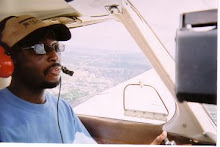
Well, before I get into the story, I will warn you ahead of time that this flight was on my Microsoft Flight Simulator, which also has Ultimate Terrain software. What I really like about the software is that it adds in many landmarks that the regular flight simulator does not have.
I started from Bolton airfield in Columbus and flew to route direct to Stewart Airfield which is approximately a 52 mile flight direct.
I will have to grade myself a C- due to a few mental errors. And while some will laugh or roll their eyes at simulating a flight such as this, to me and many other pilots this allows us to work on our routines and procedures such as using the check list, navigation, and get used to many procedures, many which are mandatory, and the simulator allows us to learn on the ground when it is not going to get us killed, or written up by the FAA.
I had a few minor glitches from the beginning such as not having the correct frequencies written down, but that will clear up as soon as I start using this flight planning sheets. My taxi, take off, and climb out were pretty much within guidelines and I was able to maintain the compass heading fairly well most of the flight. Also keep in mind, I am using the magnetic compass and not be directional gyro on the panel. The funny thing is that when using the magnetic compass you are always turning in the opposite direction to achieve the correct compass heading.
My first landmark pretty much was within two to three minutes, but absentmindedly I had climbed to 3500 feet as planned, but should have planned for a climb to 4500 feet due to my true course heading. Even though the 3500 foot altitude I was still legal because I was just about 2000 feet above ground I still have a cushion before I had to adhere to the even and odd altitude assignments.
My second checkpoint came a lot sooner than I figured. After I completed my flight I figured out what the problem was. Pilot error, garbage in, garbage out. After I got to my final reference point which is located about 4 miles east of the airport I had to search for the airport for a few minutes before I found it. From there, I entered a 45 into the upwind leg and everything after that pretty much was routine. And by the way, the landing was good, and the right beyond the threshold which is where I went to idle on the downwind leg.
Once I get back up in the air in a few weeks I should move right into my dual cross country.
And one final note. When my friend Steve flew up from Stewart, I was at the airport waiting for him. But when I landed at Stewart tonight on my flight simulator I expected to at least see a little animated pilot waving at me as I landed. I guess I was asking for a little too much?


1 comment:
That's what you get for not installing the Ultimate Steve software!
Having flown 40I-TZR three times now, I must say that there's not a ton in between the two airports. Still, I'm sure it's much easier to pick out checkpoints as compared to MSFS.
Looking forward to the day you finally land at Stewart. I will indeed be down there waving... :)
Post a Comment